Shipping quote request
We’ll calculate the shipping price as soon as getting your request.
Shipping quote request
We’ll calculate the shipping price as soon as getting your request.
You May Also Like
More from this Dealer
Early 17th Century Dutch Map of South America, 1633

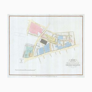
Nashs Plan to Redevelop Charing Cross
16th Century Map of Barcelona by Valegio, 1598

Map of the British Isles with Decorative Borders

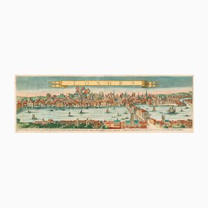
Antique Map of London by Gabriel Gualdo Priorato, 1675
The City and Whitechapel from a Large-Scale Survey of London

Large and Detailed Chart of the Bahamas, 1700s

18th Century Map of Italy in Fine Colour

Early 18th Century Warship Chart

Spanish Sea Chart of Madagascar and Mozambique

Colourful Map of the History of London, 1970s

Orteliuss Landmark Map of China

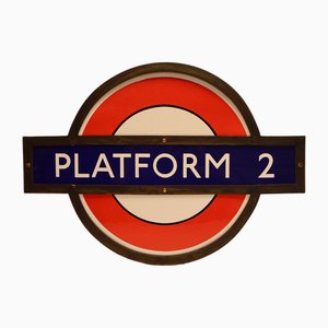
Early London Underground Platform Roundel, 1930
Plan of the Ottoman Siege of Belgrade, 1739

18th Century Two-Sheet Map of Ancient Greece from Aeg

Detailed Map of Knightsbridge, Chelsea and Kensington

Holborn Tube Station Roundel, 1950

18th Century Map of Tuscany and the Papal States

You Are Here Poster for Holborn Underground Station

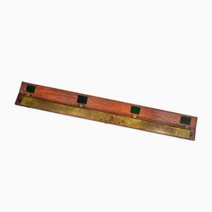
Early 19th Century Brass Navigators Tool by William Carys, 1800
More Products


Get in Touch
Make An Offer
We noticed you are new to Pamono!
Please accept the Terms & Conditions and Privacy Policy
Get in Touch
Make An Offer
Almost There!
To follow your conversation on the platform, please complete the registration. To proceed with your offer on the platform, please complete the registration.Successful
Thanks for your inquiry, someone from our team will be in touch shortly
If you are a Design Professional, please apply here to get the benefits of the Pamono Trade Program